GPS Solutions
GPS Solutions for Utility Mapping, Data Collection & Asset Relocation
At Eastcom Associates, we provide rugged, high-precision GPS solutions built for professionals in utility mapping, infrastructure management, and environmental services. Whether you’re locating underground utilities, managing field assets, or capturing geospatial data, our GPS systems deliver the accuracy, integration, and reliability required for high-stakes field operations. With over 120 years of combined expertise in utility locating technologies, Eastcom is a trusted distributor of industry-leading brands like Juniper Systems, Radiodetection, UTTO, and Trimble.


GPS Solutions: Technical Guide
GPS Solutions provides high-accuracy positioning for utility locating, surveying, construction layout, and GIS data collection. Modern GPS/GNSS receivers use multi-constellation satellites, correction sources, and advanced processing to deliver sub-meter to centimeter-level accuracy in the field. Eastcom Associates supplies rugged, professional-grade GPS systems built for engineering, utility, and municipal applications.
How High-Precision GPS Works
GPS accuracy depends on the correction data available to the receiver.
Correction Methods & Typical Accuracy
RTK GPS delivers the highest accuracy and is the preferred solution for engineering, survey, and utility applications.
Core Applications of GPS Solutions
Utility Locating & Mapping
- Capture precise horizontal/vertical asset locations
- Integrates with EM locators, GPR, GIS platforms, and mobile mapping apps
- Supports utility record accuracy and reduces excavation risk
Surveying & Construction
- Establishes control points, site layout, and elevation checks
- Provides sub-inch accuracy for civil and municipal engineering
- Ideal for as-builts, grading, and infrastructure documentation
GIS & Asset Management
- Field crews capture accurate attributes and geometry
- Compatible with ArcGIS, QGIS, AutoCAD, MicroStation
- Supports municipal, telecom, pipeline, and environmental databases
Environmental & Land Management
- Boundary mapping, forestry analysis, hydrological features
- Ideal for long-term monitoring programs
Key Technical Features of Modern GPS Systems
Multi-Constellation Tracking
Improves accuracy and reliability in difficult environments.
Real-Time RTK Corrections
Delivers 1–2 cm precision via:
- Cellular RTK networks
- UHF radios
- Base-rover configurations
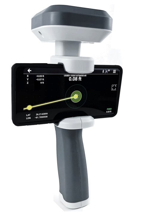
Tilt Compensation
IMU sensors allow accurate shots even when the survey pole is not perfectly vertical.
Benefits:
- Faster data collection
- Accurate shots near buildings or obstacles
- Reduced rework
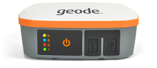
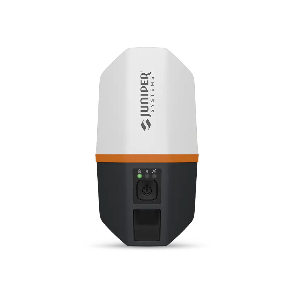
Rugged Field Hardware
- IP65–IP68 ratings
- Shock and vibration resistant
- Built for utility, survey, and construction environments
Advanced Data Tools
- Real-time map display
- Attribute tables
- CAD/GIS export formats
- Cloud syncing and team collaboration
Feature Overview
Performance Considerations for Selecting a GPS Receiver
1. Environment
- Tree canopy, buildings, and terrain affect signal quality.
- Multi-constellation receivers improve performance in these areas.
2. Correction Availability
- RTK provides the best accuracy but requires network coverage.
- PPP is ideal for remote environments without cell service.
3. Workflow Integration
- Cloud-connected systems reduce office processing time.
- Integrated mobile apps streamline GIS and utility mapping.
4. Data Volume
- High-resolution mapping generates large datasets requiring robust software.
5. Operator Skill
- RTK and advanced configurations require some training.
Choosing the Right GPS System
When selecting a GPS solution, consider:
- Required accuracy: mapping-grade vs. survey-grade
- Field conditions: canopy cover, urban areas, terrain
- Correction availability: RTK network vs. PPP
- Software workflow: GIS, CAD, GPR, utility mapping
- Team skill level: complexity of setup and calibration
- Budget and lifecycle needs: receivers, controllers, subscription costs
Eastcom helps evaluate each requirement and match your project to the correct GNSS receiver and software workflow.
Why Choose Eastcom for GPS Solutions?
Eastcom Associates provides professional-grade GPS receivers backed by:
- Expert consultation
- Hands-on training and field support
- Integration with GPR, electromagnetic locating, and GIS software
- Solutions for surveyors, utilities, municipalities, and contractors
Whether you need centimeter-level precision or rugged mapping-grade GPS, Eastcom delivers technology built for real-world engineering and field use.
➡ Contact Eastcom today to find the best GPS system for your workflow.